Department of Strategic Foresight & Scenario Planning · Articles · Geopolitics ·
China’s Medog Dam and India’s Brahmaputra Water Security: Hydropolitics, Risks and Strategic Response
China’s Medog hydropower project on the Yarlung Tsangpo is transforming the Brahmaputra basin from a shared ecological system into a growing arena of strategic contestation. With a proposed capacity of nearly 60,000 MW, the project has intensified Indian concerns over downstream water security, flood risks, ecological disruption and Beijing’s potential use of upstream infrastructure as geopolitical leverage. India’s proposed Upper Siang Multipurpose Project seeks to counter these vulnerabilities, but a dam-for-dam response may introduce additional seismic, environmental and human-security risks in an already fragile region. This article examines the evolving hydropolitics of the Brahmaputra, arguing that without durable mechanisms for transparency, hydrological data sharing and basin-wide cooperation, competing infrastructure ambitions could deepen strategic mistrust while amplifying the vulnerabilities of communities across India, China, Bhutan and Bangladesh.
Introduction
The rapidly advancing construction of China's Medog hydropower project on the Yarlung Tsangpo (Brahmaputra), is projected to become the world's largest hydroelectric dam with an installed capacity of around 60,000 MW. Following its formal launch in July 2025, the project has exacerbated India’s concerns over the implications that China’s upstream dam building will have on downstream water security, ecological sustainability and potential use of water as geopolitical leverage.
In response, India has accelerated plans for its Upper Siang Multipurpose Project, which besides augmenting hydropower generation and water storage capacity, is intended to mitigate the potential downstream impacts and serve as a strategic countermeasure to China's upstream dam building on the Yarlung Tsangpo. Together, these developments are transforming the ecologically fragile and seismically active Brahmaputra basin into an arena of strategic contestation, carrying significant non-traditional security ramifications for downstream riparian states.
China’s Upstream Hydropower Ambitions
China’s pursuit of the Medog hydropower dam stems from its broader strategy of harnessing hydropower of both, the domestic rivers as well as utilising upstream waters of the transboundary rivers. The past decade has seen Beijing build extensive dam activities across its river systems, such as ‘The Three Gorges dam’ on the Yangtze, the world’s largest hydroelectric power station with a capacity of 22,500 MW.
The magnitude and impact of the ‘Three Gorges Dam’ is illustrated by the fact that at its full capacity, the reservoir by storing roughly 39 trillion kilograms of water slows down Earth’s rotation spin by 0.06 microseconds and also shifts the position of the two poles by 2cm.
Over the past two decades, Beijing has constructed a cascade of dams on the Lancang (upper Mekong), including 11 major dams on the river's mainstream and numerous others on its tributaries within Chinese territory. While these projects have significantly enhanced China's hydropower generation capacity, they continue to have drastic societal and ecological impacts among downstream riparian states namely Myanmar, Thailand, Laos, Cambodia, and Vietnam.
Studies have linked China's upstream flow regulation on the Mekong to altered seasonal flows, reduced sediment transport, and disruptions to fisheries and agriculture, affecting the livelihoods of nearly 70 million people across the Lower Mekong Basin. Concerns intensified during the 2019–2020 drought, when several studies alleged that China retained substantial volumes of water in its upstream reservoirs despite severe downstream water shortages. The Mekong experience highlights China’s transboundary river governance approach which historically has been shaped by a strong emphasis on territorial sovereignty and developmental imperatives and continues to shape India's threat perceptions on China's expanding upstream infrastructure over the Yarlung Tsangpo which could be potentially leveraged to influence downstream water flows into the Brahmaputra Basin.
The River course and the project
The Yarlung Tsangpo originates near Mount Kailash, in the Angsi Glacier in western Tibet and flows eastwards across the Tibetan Plateau making a dramatic U-turn at the Great Bend near Medog

Source: (The Print, 2025)
The river subsequently enters India through Arunachal Pradesh, known as the Siang, before flowing into Assam as the Brahmaputra and eventually entering Bangladesh as the Jamuna, where it joins the Padma before emptying into the Bay of Bengal. It is at this strategically significant Great Bend region characterised by the world's steepest river gradients and immense hydropower potential that China is constructing the Medog hydropower project.

Source: (The Print, 2025)
The project has a proposed installed capacity of around 60,000 MW (60 GW), nearly three times that of the ‘Three Gorges Dam’ (22,500 MW), which upon completion, would make it the largest hydroelectric project globally.
The fact that the project formed part of China's Fourteenth Five-Year Plan (2021–2025), underscores Beijing's growing emphasis on harnessing the hydropower potential of transboundary rivers originating on the Tibetan Plateau. The Medog project’s strategic significance was highlighted by statements from senior Chinese officials, including Yan Zhiyong, Chairman, Power Construction Corporation of China, who described the project to be of ‘national security significance’, particularly in relation to China’s water and domestic security. In the backdrop of China’s broader ambition to achieve carbon neutrality by 2060, the hydropower potential of the Yarlung Tsangpo has assumed increased strategic importance in Beijing’s energy transition and development planning. The Chinese government granted formal approval to the project in 2024 and construction commenced in July 2025.
India-China hydrological relations
India-China relations are closely intertwined with the broader trajectory and its cooperation on transboundary rivers, evolving from a phase of engagement during the 1990s and 2000’s to one increasingly characterised by strategic contestation since 2020. Despite persistent differences in their respective approaches to transboundary river governance, the two countries established several institutional mechanisms aimed at promoting hydrological cooperation and confidence-building.
One of the earliest was the 1993 Agreement on Cooperation in the Field of Environment, which provided a framework for scientific exchanges and collaboration on issues such as biodiversity conservation, climate change, water quality protection, and environmental legislation, followed by a series of bilateral agreements and Memoranda of Understanding (MoU’s) aimed at strengthening scientific and technological cooperation. These were extended to transboundary rivers, particularly the Brahmaputra. In 2002, India and China signed an MoU under which China agreed to provide hydrological data on the Brahmaputra during the flood season (15 May to 15 October), enabling India to better prepare for floods in downstream regions. Cooperation was subsequently expanded through a similar MoU on the Sutlej River, by establishing an Expert-Level Mechanism (ELM) in 2006 to discuss transboundary river issues, and successive renewals of data-sharing arrangements in 2008 and 2013. Notably, the 2013 agreement provided for the sharing of more comprehensive hydrological data. Collectively, these agreements and institutional mechanisms are some of the few tangible diplomatic achievements in India-China relations which once facilitated limited yet functional cooperation on transboundary rivers despite broader political differences. However, such cooperation remained narrowly confined to technical data-sharing and confidence-building measures.
The Hydrological Challenges
In 2017, these limited cooperative arrangements have come under increasing strain amid broader political and strategic tensions between India and China. During the 73-day Doklam standoff in 2017, China suspended the sharing of hydrological data on the Brahmaputra for the first time, citing technical reasons, raising concerns in India regarding the vulnerability of existing cooperation mechanisms. High-level diplomatic engagements subsequently led to the renewal of the MoU in 2018, with China resuming the sharing of hydrological data on the Brahmaputra and Sutlej and both sides reinstating the Expert-Level Mechanism (ELM) on transboundary rivers. However, this rapprochement was short-lived.
The deterioration in bilateral relations following the Galwan Valley clashes in 2020 further undermined transboundary hydrological cooperation. China's commissioning of the 360 MW Jiacha Dam on the Yarlung Tsangpo in Tibet, coupled with official announcements regarding the proposed Medog hydropower project at the Great Bend, heightened Indian concerns over Beijing's expanding upstream footprint and the potential use of water as a strategic lever during periods of heightened tensions. India’s ministry of Jal Shakti had revealed that China had stopped sharing hydrological data to India since 2022. The last meeting of the Expert-Level Mechanism was held in 2023. The same year the existing MoU on hydrological data-sharing expired and despite continued diplomatic engagements, no formal renewal has been announced thus far.
The Potential Medog Threat
The weakening of India-China hydrological cooperation reflects fundamental differences in the approaches to transboundary river governance. Against the backdrop of eroding institutional mechanisms and growing strategic distrust, India’s threat perceptions regarding the Medog hydropower project stems not merely from its scale and location, but from deeper divergences on how New Delhi and Beijing conceptualise and govern transboundary rivers.
India’s approach to transboundary rivers has been characterised by a willingness to engage in negotiated arrangements even in difficult political contexts, as reflected in agreements such as the Indus Waters Treaty with Pakistan and the Ganges Water Sharing Treaty with Bangladesh. China, by contrast, has historically avoided comprehensive water-sharing treaties with its neighbours. It has not ratified the 1997 UN Convention on the Law of the Non-Navigational Uses of International Watercourses arguing that international water law frameworks, impose disproportionate obligations on upstream states and constrain sovereign rights over rivers originating within its territory, including those on the Tibetan Plateau.
In practice, hydrological cooperation between India and China has, at its best, been limited to narrow technical arrangements, primarily confined to seasonal data sharing on transboundary rivers and even these arrangements have been inconsistently implemented, with instances of suspension during periods of political tension, viz., the Doklam standoff in 2017 and the Galwan Valley clashes in 2020. While China attributed disruptions in hydrological data sharing with India in 2017 to technical upgrades of monitoring stations in Tibet, during the same period information continued to be shared with Bangladesh., underscoring the selective and politically conditioned nature of China’s hydrological engagement.
Non-Traditional Security Ramifications
China's hydropower development on the Yarlung Tsangpo system has not been limited to the Medog project alone. Over the past two decades, a series of upstream projects, including Zangmu, Jiacha, Dagu, and Jiexu, have gradually expanded China's infrastructure footprint on the river and its tributaries in Tibet. While individually characterised as run-of-the-river projects with limited storage capacity, their cumulative presence has raised concerns in India regarding the incremental flow regulation and evolving upstream hydrological control. Hydrological patterns derived from open-source datasets and remote sensing further indicate intermittent flow variability in recent years along with storage capacity in reservoirs such as Rakshasa Tal declining particularly post 2021. Both the developments point out the increasing upstream water management interventions by China even prior to the Medog Project.
Hydrologically, the Brahmaputra basin is marked by pronounced asymmetries in discharge contribution. Although nearly half of the basin lies within Chinese territory, China contributes only around 22–30 per cent of the river's total discharge owing to the cold and arid climatic conditions prevailing on the Tibetan Plateau. In contrast, Bhutan, despite accounting for merely 6.7 per cent of the basin area, contributes approximately 21 per cent of total flows, while the Indian catchment contributes the largest share at nearly 39 per cent. Consequently, only 14% of the Brahmaputra's total discharge is present in the river before it enters India, with the overwhelming 86% being generated after entering India through monsoonal rainfall and tributaries such as the Siyom.
Against this backdrop, the now under construction, Medog hydropower project, represents a significant escalation in both scale and strategic implications. The location of the project at the Great Bend and the envisaged diversion of nearly half of the river flow around 2,000 cubic metres per second, through approximately 20 km-long tunnels, to generate an estimated 60 GW of electricity annually have intensified concerns regarding downstream water security. The water security particularly during the lean season, when reduced flows could significantly affect river continuity and water availability prior to monsoon replenishment are of serious concern for India. India's primary concern relates to upstream flow regulation during the lean season and the possibility of abrupt, unannounced releases of water from large reservoirs, which could significantly exacerbate flood risks downstream. As highlighted by Arunachal Pradesh Deputy Chief Minister Chowna Mein, an uncontrolled release of water from a mega-reservoir such as Medog could potentially inundate large parts of the Siang region, the Brahmaputra Valley, and critical infrastructure downstream.
Large-scale flow regulation on the Yarlung Tsangpo could also generate significant water, livelihood, and ecological insecurities downstream. In Bangladesh, a 2022 Ministry of Environment report estimated that a mere 5 per cent reduction in river flows could reduce agricultural output by as much as 15 per cent in certain regions, exacerbating food insecurity and accelerating salinity intrusion in coastal areas. Similar concerns exist in India, particularly in Assam, where the Brahmaputra irrigates nearly 70 per cent of agricultural land and contributes around 25 per cent to the state's GDP. Any Sudden releases or reduced dry-season flows could aggravate water stress and flooding in Assam where nearly 40 per cent of the area is already flood-prone.
Importantly, the risks are not confined to deliberate actions by China alone. The Medog project is located in the Indo-Tsangpo Suture Zone, one of the world's most seismically active regions, where the Indian and Eurasian tectonic plates continue to converge. The region has witnessed devastating seismic events in the past, most notably the 1950 Assam-Tibet earthquake (M 8.6). Given the unprecedented scale of the Medog project, geologists have warned that extensive tunnelling and large-scale engineering interventions in this fragile mountain terrain could further destabilise active fault systems. Any landslide in the region due to earthquake, dam failure, or glacial lake outburst flood (GLOF) could unleash catastrophic flooding, threatening millions of people residing in downstream areas of Arunachal Pradesh, Assam, and Bangladesh.
Further the dam project may disrupt sediment transport, critical for maintaining riverbed stability and soil fertility in the Ganges-Brahmaputra-Meghna delta system, thereby leading to deltaic erosion, diminishing agricultural productivity, and adversely affecting biodiversity across the Eastern Himalaya biodiversity hotspot. An example are the 218 fish species supported by Brahmaputra, including commercially important Hilsa and Mahseer, whose migratory patterns could be disrupted, threatening the livelihoods of nearly two million fishers in India and Bangladesh. Hilsa fisheries alone contribute approximately US$1 billion annually to Bangladesh's economy. Furthermore, declining sediment deposition would accelerate mangrove degradation in the Sundarbans, weakening coastal resilience and reducing the region's carbon sequestration capacity, exacerbating the climate vulnerability of an already fragile ecosystem.
India’s Upper Siang Multi-Purpose Dam
These non-traditional security threats associated with the Medog project, and the persistent absence of comprehensive hydrological cooperation with China, have prompted India to advance its own proposed response in the form of the Upper Siang Multipurpose Project (SUMP), an 11,000 MW storage-based dam on the Siang River in Arunachal Pradesh.

Source: (Hazarika, 2025)
Beyond its hydropower generation potential and provision of 12 per cent free power to the state, the project is strategically framed around mitigating downstream risks from upstream Chinese interventions. This includes asserting hydrological rights, enhancing flood control capacity through a proposed 9 billion cubic metre reservoir designed to buffer sudden upstream surges, and strengthening India’s position as a lower riparian stakeholder.
However, despite its strategic rationale, the SUMP itself carries significant ecological and climate-related risks. The project is located within the Siang basin, approximately 82 per cent of which is forested and recognised as a global biodiversity hotspot, raising concerns over large-scale ecological disruption and loss of fragile habitat systems. In addition, both the SUMP and China’s Medog project fall within Seismic Zone V, a highly active tectonic region where reservoir-induced seismicity remains a credible risk, particularly given the scale of proposed reservoir impoundment, in both the projects. As a result, several scientific assessments have called for caution, with some urging the suspension of SUMP related preparatory activities in the region.
Discussion
In this context, India’s “dam-for-dam” response, rather than mitigating the risks posed by upstream Chinese interventions, may inadvertently amplify ecological and seismic vulnerabilities in an already fragile Brahmaputra River system. This parallel development of large-scale hydropower infrastructure on both sides of the border risks transforming the Brahmaputra basin into an increasingly contested hydrological space. The competing infrastructure strategies instead of protecting their hydrological sovereignty may end up or even contribute to, rather than alleviate, the region’s non-traditional security challenges.
However, the resulting dynamic is not one of zero-sum hydrological control, but of overlapping vulnerabilities. The Brahmaputra basin remains hydrologically dependent on monsoonal systems and downstream tributaries, limiting the scope for complete upstream control by China, yet it is increasingly exposed to risks arising from large-scale flow regulation, infrastructural concentration, and climatic and seismic fragility. In this context, both upstream and downstream hydropower expansions risk amplifying non-traditional security challenges rather than resolving them, particularly in a basin already marked by ecological sensitivity and high disaster exposure.
Conclusion
The evolution of hydro-politics in the Brahmaputra basin underscores a broader shift from limited technical cooperation to increasing strategic contestation between India and China. While the Medog hydropower project reflects Beijing’s growing emphasis on harnessing the energy potential of transboundary rivers originating on the Tibetan Plateau, it also highlights the structural limitations of existing India–China hydrological engagement, which has remained narrow, irregular, and highly sensitive to broader geopolitical tensions. At the same time, India’s response through the proposed Upper Siang Multipurpose Project reflects both the absence of robust basin-wide governance mechanisms and the growing tendency towards unilateral infrastructure-based risk mitigation.
Ultimately, the trajectory of India–China hydro-politics suggests that in the absence of durable institutional mechanisms for transparency, data sharing, and basin-level cooperation, at the Brahmaputra is likely to remain a site of strategic mistrust. More critically, it risks becoming an arena where competing infrastructure responses reinforce rather than reduce environmental and human security vulnerabilities across India, China, Bhutan, and Bangladesh.
The views expressed are those of the authors and do not represent the views of CNAWS.
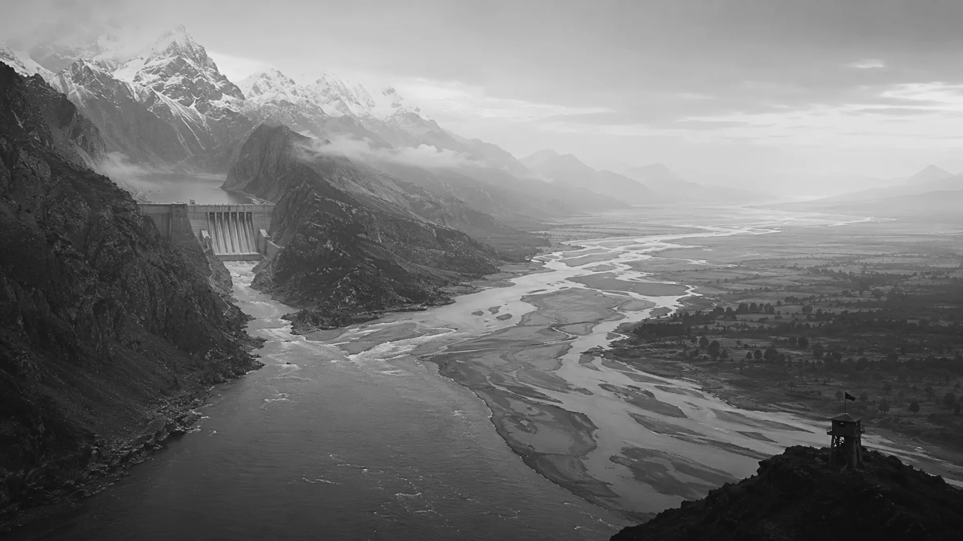
Image Source: ChatGPT
Tags
- #Brahmaputra Hydropolitics
- #Brahmaputra River
- #China
- #China Hydropower Projects
- #India Water Security
- #India-China Water Dispute
- #Medog Dam
- #Transboundary River Governance
- #Upper Siang Dam
Author
Himanshu Kulkarni
Himanshu Kulkarni is a political economist, researcher and writer. He holds a Bachelor’s degree in Socio-Economic Policy from University of Canberra (Australia), a Master’s in International Relations, Security and Strategy from OP Jindal University and a Master’s in Political Economy of Development from SOAS University of London, UK. His research areas are Political Economy, Geo Economics, Non-traditional Security and Resource politics.